
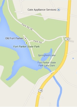
Fort Parker State Park
Rendezvous time has changed 04/07/2014
|
Date: April 13 14,
2014 |
Sponsor: DDRC |
|
River: Lake
Fort Parker & the Navasota River |
Trip Leader: Dale
Harris |
|
Reach: Lake
Fort Parker & the Navasota River |
Phone: 972-814-2633 |
|
Difficulty: Flat
water / easy / this trip is good for beginners |
|
|
Rendezvous: Fort
Parker State Park campgrounds, Sunday
April 13th, at Noon
|
Required Skills:
Basic winter flat-water paddling and camping experience |
|
Backup
Plan: This trip will be rescheduled in case of inclement weather |
Confirmation Deadline: None |
Trip Description:
Fort Parker
State Park: This is a Sunday / Monday trip for those of us who
work on Saturdays!! Several people have been asking
for a camping trip that didn't start of Friday or Saturday. So please join me
on April 13th, 2014 at Fort Parker. The park is located approximately 110
miles south of Dallas near Mexia, TX. It is on Lake Fort Parker which is
beautiful medium size lake with a nice campground. It is one of the clubs
favorite campgrounds. And since it is so close it can be day trip - albeit a
long day trip.
Everyone needs to make their
own arrangements for lodging at Fort Parker State Park. Arrive on Sunday morning and set up camp
and paddle around the lake. Right now there are plenty of sites open, but depending
on site availability you may not be able to check in on Sunday until 2pm.
We will meet in the camping area of the campground
on Monday at 9am. We will run our shuttle and paddle the Navasota River
hopefully getting on the water by 10am. We should get back to the
campground by 12:30 at the latest.
|
Google Earth Users |
|
* International Scale
of River Difficulty
Class I: Easy. Fast
moving water with riffles and small waves. Few obstructions, all obvious and
easily missed with little training. Risk to swimmers is slight, self-rescue
is easy. Class II: Novice. Straightforward rapids with wide, clear
channels which are evident without scouting. Occasional maneuvering may be
required, but rocks and medium sized waves are easily missed by trained
paddlers. Swimmers are seldom injured and group assistance,
while helpful, is seldom needed. Class III: Intermediate. Rapids with moderate, irregular waves
which may be difficult to avoid and which can swamp an open canoe. Complex
maneuvers in fast current and good boat control in tight passages or around
ledges are often required; large waves or strainers may be present but are
easily avoided. Strong eddies and powerful current effects can be found,
particularly on large-volume rivers. Scouting is advisable for inexperienced
parties. Injuries while swimming are rare; self-rescue is usually easy but
group assistance may be required to avoid long swims. Class IV: Advanced. Intense, powerful but predictable rapids
requiring precise boat handling in turbulent water. Depending on the
character of the river, it may feature large, unavoidable waves and holes or
constricted passages demanding fast maneuvers under pressure. A fast,
reliable eddy turn may be needed to initiate maneuvers, scout rapids, or
rest. Rapids may require "must" moves above dangerous hazards.
Scouting is necessary the first time down. Risk of injury to swimmers is
moderate to high, and water conditions may make self-rescue difficult. Group
assistance for rescue is often essential but requires practiced skills. A
strong eskimo roll is highly recommended. Class V: Expert. Extremely long, obstructed, or very violent
rapids which expose a paddler to above average endangerment. Drops may
contain large, unavoidable waves and holes or steep, congested chutes with
complex, demanding routes. Rapids may continue for long distances between
pools, demanding a high level of fitness. What eddies exist may be small,
turbulent, or difficult to reach. At the high end of the scale, several of
these factors may be combined. Scouting is mandatory but often difficult.
Swims are dangerous, and rescue is difficult even for experts. A very
reliable eskimo roll, proper equipment, extensive
experience, and practiced rescue skills are essential for survival. Class VI: Extreme. One grade more difficult than Class V.
These runs often exemplify the extremes of difficulty, unpredictability and
danger. The consequences of errors are very severe and rescue may be
impossible. For teams of experts only, at favorable water levels, after close
personal inspection and taking all precautions. This class does not represent
drops thought to be unrunnable, but may include
rapids which are only occasionally run. |
![]()
![]()
|
Copyright © 1996-2011, Dallas Downriver Club. All rights
reserved. You may not copy, distribute, or use these materials except
for your personal, non-commercial use. Any trademarks are the property of
their respective owners. All original photographic images are the exclusive
property of Dallas Downriver Club or other designated photographers and may
not be copied, duplicated, reproduced, distributed or used in any manner
without prior written permission of the copyright owner under penalty of US
and International laws and treaties. Last updated
|